When investors discuss opportunities in Eastern Visayas, attention often gravitates toward Tacloban City, Leyte, and Samar. Yet beyond the region’s established centers lies a province quietly positioning itself for future growth—Southern Leyte.
Traditionally viewed as an agricultural province, Southern Leyte is increasingly emerging as a strategic growth corridor driven by transportation connectivity, tourism development, public infrastructure investments, and its unique position as the gateway between the Visayas and Mindanao.
While it may not yet command the same level of investment attention as larger provinces, many of the ingredients necessary for long-term economic expansion are already in place.
Strategic Location: The Province’s Strongest Asset
Geography often determines economic destiny.
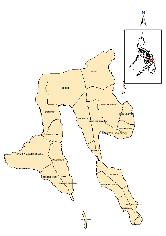
Southern Leyte occupies a critical location at the southern end of Leyte Island, serving as the principal land and sea connection between Eastern Visayas and Northeastern Mindanao. The Liloan–Surigao route is one of the busiest inter-island transport links in the country, facilitating the movement of passengers, agricultural products, consumer goods, and commercial cargo.
This strategic position provides Southern Leyte with a natural competitive advantage in logistics, transportation, warehousing, and trade-related activities. As national infrastructure programs continue to improve roads, ports, and digital connectivity, the province stands to benefit from increased regional integration and economic mobility.
A Multi-Centered Provincial Economy
Unlike provinces dominated by a single urban center, Southern Leyte is developing through multiple growth nodes.
As the provincial capital, Maasin City functions as the center of government, education, healthcare, finance, and commerce. It serves as the primary urban market for the province and remains the focal point for public and private investments.
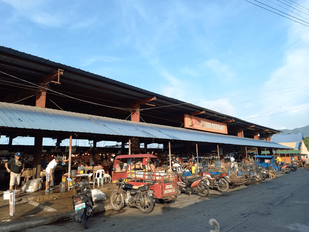
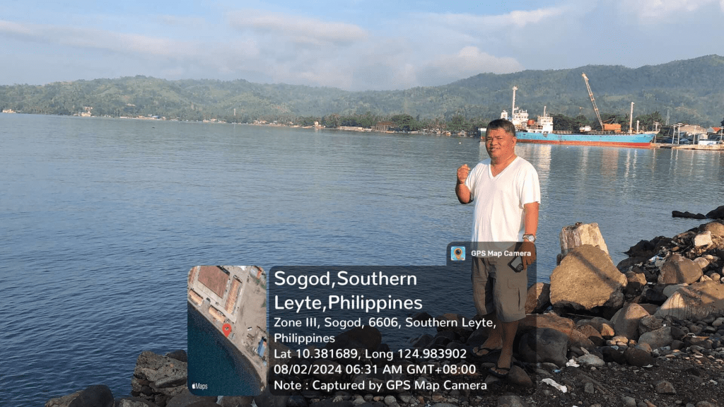
Sogod, the province’s only first-class municipality, has become an important commercial and transportation hub. Located along the Sogod Bay area, it serves as a crossroads connecting various municipalities and facilitating regional trade.
Hinunangan and neighboring municipalities provide agricultural production, fisheries resources, and growing commercial activity that contribute significantly to the provincial economy.
Together, these centers create a more resilient economic structure by distributing opportunities across the province rather than concentrating development in a single location.
Competitive Advantage and Economic Driver
While agriculture is often viewed as a traditional sector, it continues to provide Southern Leyte with a strong economic foundation.
The province’s major products include:
Coconut
Rice
Abaca
Fisheries products
Fruits and vegetables
Among these, abaca deserves special attention. As global industries increasingly seek sustainable and natural fibers, abaca presents opportunities for value-added processing, manufacturing, and export-oriented enterprises.
The challenge moving forward is not simply increasing production but strengthening agricultural value chains through processing facilities, logistics systems, market access, and technology adoption.
Southern Leyte possesses one of the most underappreciated tourism portfolios in the country.
Its attractions include:
Sogod Bay’s marine ecosystems
Whale shark encounters
Diving destinations
Limasawa Island, recognized as the site of the first recorded Easter Mass in the Philippines
Waterfalls, caves, and mountain landscapes
Coastal ecotourism destinations
Unlike highly urbanized tourism centers that face congestion and environmental pressures, Southern Leyte still enjoys the advantage of relatively intact natural resources.
This creates opportunities for sustainable tourism investments, including:
Eco-resorts
Dive tourism facilities
Adventure tourism
Community-based tourism enterprises
Heritage tourism development
As global tourism trends increasingly favor authentic and environmentally responsible experiences, Southern Leyte is well-positioned to compete.
Compared with highly urbanized markets, land values in many parts of Southern Leyte remain relatively affordable, creating opportunities for long-term investors willing to take a strategic view of future growth.
The province’s demographic expansion, infrastructure improvements, and economic diversification suggest that urban land demand is likely to increase over time.
Infrastructure as a Growth Catalyst
Infrastructure development continues to transform the province’s economic landscape.
Key assets include:
Pan-Philippine Highway connectivity
Maasin Port
Liloan Port
Roll-on/Roll-off ferry facilities
Expanding telecommunications infrastructure
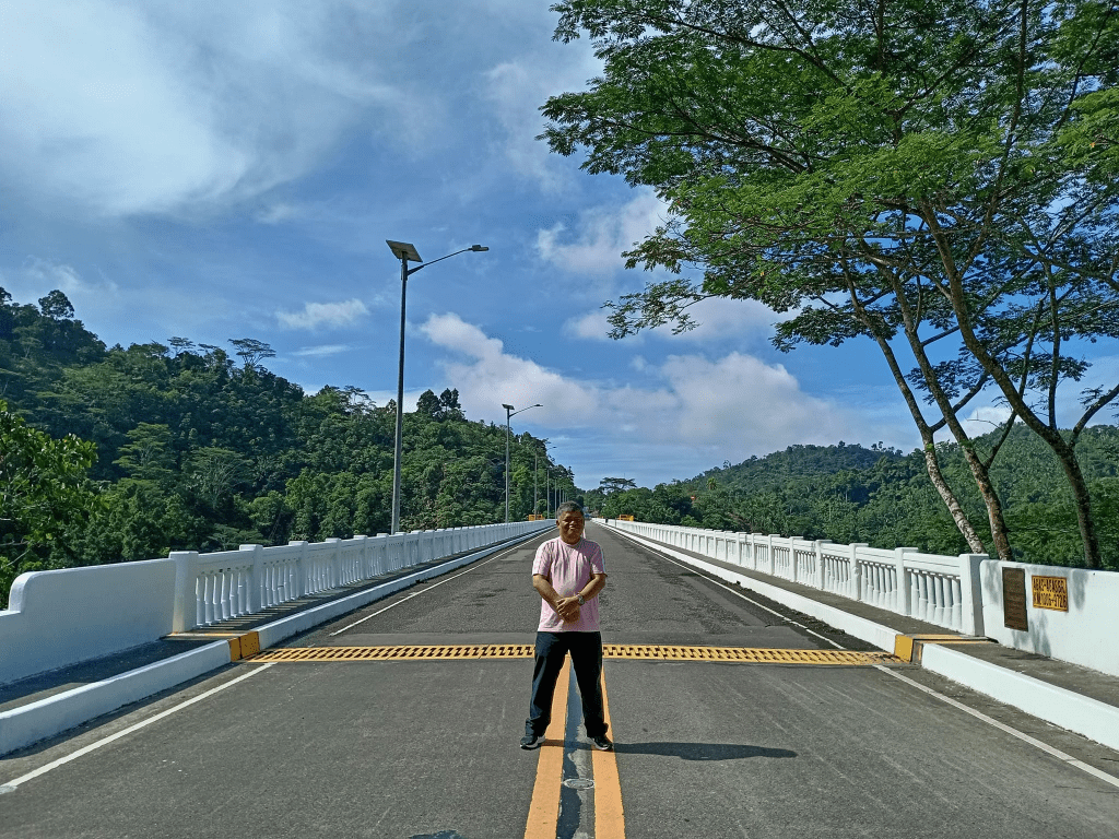
Ongoing road improvement projects
These investments reduce transportation costs, improve market accessibility, and increase the attractiveness of the province for private investment.
Infrastructure not only supports economic activity—it also shapes future land values and development patterns.
Southern Leyte may not yet be considered a major investment destination, but many indicators suggest that its trajectory is changing.
Its strategic location, agricultural strengths, tourism assets, growing infrastructure network, and relatively affordable land base provide a foundation for long-term economic development.
Cebu City has undergone an undeniable spatial and economic transformation over the past two decades. From the gleaming corporate towers of Cebu Business Park and IT Park to the booming residential subdivisions in Guadalupe and the expanding luxury hillsides of Busay, our metropolitan footprint has expanded at a breathtaking pace.
But behind this economic success story lies a frozen fiscal reality: our local tax assessment schedules haven’t been updated since 2003.
Now, under the mandatory directive of Republic Act No. 12001, otherwise known as the Real Property Valuation and Assessment Reform Act (RPVARA), Cebu City is preparing to unleash one of the most sweeping real property tax recalibrations in its contemporary history.
As an appraiser, environmental planner, and economist, I know firsthand that updating these ancient schedules is a statutory necessity to wipe out passive land speculation. But the sheer velocity and underlying philosophy of Cebu City’s proposed Schedule of Market Values (SMV) and Schedule of Base Unit Construction Cost (SBUCC) should make every property owner stop and look at the fine print.
Here is why the current draft framework is setting up an explosive collision between aggressive market-driven valuation and your statutory rights as a taxpayer.
1. The Core Legal Battle: Market Appraisal vs. “Actual Use” Taxation
The ultimate friction point in the city’s new plan is a fundamental misinterpretation of how RPVARA interacts with the long-standing “Actual Use” Doctrine codified under Section 217 of the Local Government Code of 1991.
The law states with absolute clarity:
“Real property shall be classified, valued and assessed on the basis of its actual use regardless of where located, whoever owns it, and whoever uses it.”
For decades, this rule has protected long-time citizens from being taxed out of their own neighborhoods. It dictates that you must be taxed on how you are currently using your land, not on what your land could be worth if you knocked it down and built a commercial shopping mall.
While RPVARA introduces international appraisal standards to calculate true, prevailing market values, it did not repeal Section 217 of the Local Government Code. The city is legally bound to a clear, harmonious tax formula:
$$\text{Assessed Value} = \text{Prevailing Market Value} \times \text{Assessment Level based on Actual Use}$$
Unfortunately, the proposed SMV drafts effectively look past this formula, shifting the assessment framework away from actual-use taxation toward speculative, redevelopment-based valuation.
2. The Guadalupe Architecture: Slicing Up Streets into Hyper-Granular Tax Traps
Nowhere is this shift more evident than in the raw data for Barangay Guadalupe. By moving away from a flat-rate model, the City Assessor has introduced an aggressive spatial architecture that uses rigid distance thresholds to maximize tax extraction.
Instead of an entire street sharing a uniform baseline, the new schedule implements a mathematical proximity-distance rule: properties on secondary interior roads are slammed with Commercial C-7 rates (Php30,000/sqm) if they fall within a strict 120-to-160-meter radius of a major transit junction. Cross that invisible line by a single meter, and the value drops to residential rates (PhP25,000/sqm).
   [PRIMARY URBAN CORRIDOR]
              │
              ├─► WITHIN 120–160 METERS ──► Classified as C-7 Commercial (₱30,000/sqm)
              │
              └─► BEYOND 120–160 METERS ───► Drops to R-2 / RS-4 Residential (₱25,000–₱20,000/sqm)
This creates an alarming scenario. If you own an ancestral family home that has been strictly residential for half a century, but your front door happens to fall inside that high-intensity 140-meter commercial box, your baseline land value automatically balloons by hundreds of percent. The city is essentially taxing your property based on its speculative development capacity and “Highest and Best Use” potential—running directly counter to actual-use statutory protection.
3. The Upland Speculative Paradox: Triggering Environmental Chaos
In our fragile upland districts, such as Barangay Busay and Barangay Babag, the proposed SMV spikes pose a serious policy contradiction that threatens our metropolitan climate resilience.
Historically, these areas have served as critical protected watersheds and ecological reserves. The city’s draft introduces staggering valuation jumps: a 900% spike along the Transcentral Highway and up to a 1,025% surge (reaching PhP45,000/sqm) in the premium hillside enclaves of Busay.
Here lies the paradox:
Keeping values artificially low allows passive land speculators to buy up vast tracks of environmental land for cheap and sit on them at zero cost, waiting to flip them to high-density developers.
However, spiking values by thousands of percent overnight creates an unsustainable tax burden for long-time upland residents and transitional properties. To survive the financial shock, they are forced to sell out or actively convert their eco-sensitive lands into intense, high-yield commercial tourism ventures and concrete developments.
Without targeted tax credits for environmental preservation, the city’s tax code will transform from a tool of revenue generation into a primary driver of upland urban sprawl and watershed degradation.
4. Turning a Cost Schedule into a Density Tax
The adjustments to the Schedule of Base Unit Construction Cost (SBUCC) display the exact same revenue-driven philosophy. Over the last 23 years, cumulative inflation trends in the Philippines justify a standard 2.1x to 2.4x increase in baseline construction material inputs.
While horizontal residential structures reasonably mirror this trend,high-density vertical condominiums face a jaw-dropping increase of 558% to 577% (surging up to PhP65,000/sqm for Category V-A).
The city is no longer using the SBUCC as a conservative structural replacement-cost index. Instead, it is factoring in the investment yield and vertical productivity of the real estate market. An inflated SBUCC that ignores real-world economic depreciation risks turning into a punitive penalty on urban modernization, driving up rental costs and business overhead across the board.
The Path Forward: Revenue with Equity
Modernizing Cebu City’s revenue system is necessary and long overdue to protect our local economy from predatory land hoarding. However, fiscal progress must not be achieved by executing a de facto repeal of taxpayer protections.
To ensure a balanced, lawful, and socially sustainable transition under RPVARA, the City Council and the Bureau of Local Government Finance (BLGF) must adopt structural safeguards:
Codify Actual Use Discount Factors: Pass an explicit ordinance protecting frontage and proximity-split lots, ensuring that properties continuing low-density residential, institutional, or industrial operations are insulated from speculative commercial benchmarks.
Establish Protected Subclasses: Introduce distinct categories for “Residential Frontage” and “Eco-Sensitive Upland Reserves” to shield vital watersheds and middle-income families from aggressive land capitalization.
The Immediate Shield (The 6% Cap): For the first year of implementation, the city must implement a strict 6% cap on the total tax due compared to the previous year. This acts as an immediate safety valve for family checkbooks, ensuring that no matter how high the land’s theoretical value has risen, the actual cash leaving the taxpayer’s pocket remains manageable.
The Structural Step-Up (The 3-to-5-Year Phase-in): While the true market value is locked into the city’s database from day one to keep speculators at bay, the actual taxable baseline should be phased in gradually over three to five years ( 40\% in Year 1, }70\% in Year 2, and 100\% in Year 3).
Phase in Collection over 3-to-5 Years: Implement a gradual, step-up percentage layout to prevent a sudden economic shock from destabilizing the local housing market and displacing vulnerable populations.
Taxation must remain uniform, equitable, and progressive. If Cebu City allows its property assessment system to prioritize revenue maximization over structural fairness, it will score a temporary fiscal victory at the absolute cost of public confidence, environmental safety, and constitutional due process. It’s time for our policymakers to look past the valuation maps and protect the actual use of the people.
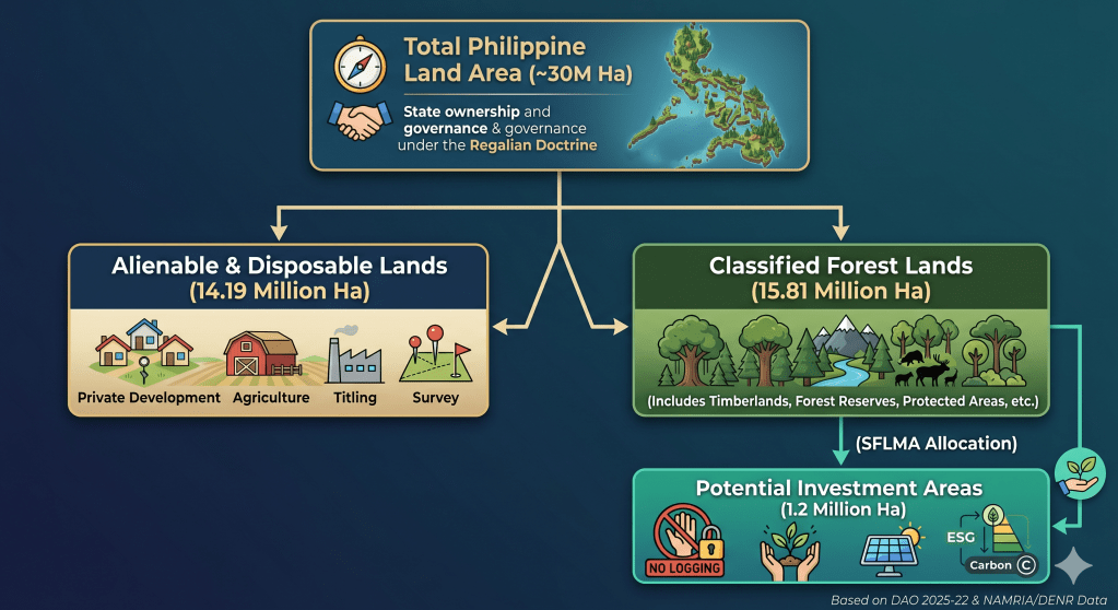
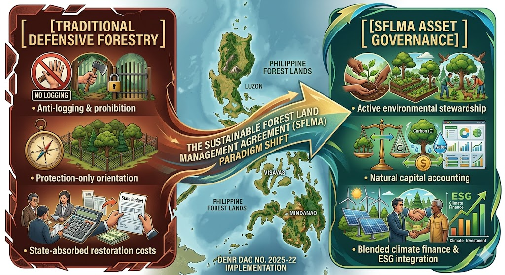
The implementation of the Sustainable Forest Land Management Agreement (SFLMA) under DENR Administrative Order No. 2025-22 marks a transformative shift from traditional, defensive forestry toward active environmental asset governance. This reform takes place against a complex legal backdrop where approximately 15.81 million hectares—over half of the Philippines’ total 30-million-hectare landmass—remain classified as public forest lands under the constitutional mandate of the Regalian Doctrine.
Historically, this system has suffered from institutional inertia, leaving official land boundaries largely unchanged since 2006 and creating a severe mismatch between legal designations and actual land use on the ground. However, the rise of the modern carbon economy has fundamentally reframed these spaces. Rather than treating forests merely as passive timber reserves or off-limits ecological zones, the SFLMA framework targets 1.2 million hectares of degraded public land—distributed across roughly 1,700 mapped parcels—to serve as climate infrastructure, carbon reservoirs, and natural capital assets.
Ultimately, this initiative places Philippine land governance at a critical intersection. The central challenge moving forward is balancing market-driven climate investments and carbon governance with the enduring constitutional principles of stewardship, social justice, and intergenerational responsibility.
II. The Carbon Economy and Legal Consolidation
One of the most consequential dimensions of the SFLMA is its architectural role in the emerging carbon economy. As international compliance and voluntary carbon markets mature, the framework provides the administrative and tenurial foundation required to host land-based carbon projects, verify forest carbon sequestration, and generate tradable carbon credits.
By offering long-term tenurial security, the SFLMA lowers the political and regulatory risk for institutional investors looking to fund nature-based solutions (NbS). Reforestation projects under this framework are uniquely positioned to serve as high-quality carbon sinks capable of issuing verified offsets for both domestic and international transfer.
Furthermore, this framework serves a critical state interest in regulatory streamlining. The SFLMA replaces and consolidates older, fragmented forest tenure systems, officially retiring:
Select commercial components of Community-Based Forest Management Agreements (CBFMA)
By collapsing these disparate instruments into a single governance mechanism, the DENR aims to eliminate conflicting land-use mandates, minimize institutional red tape, and lower transaction costs for clean-energy and conservation proponents. As the DENR noted during its rollout, the framework is explicitly designed to simultaneously generate rural employment, stimulate local economies, and boost the national gross domestic product (GDP) through sustainable forest enterprises.
III. Operationalizing SFLMA through the PENCAS Act
To properly realize its potential, the SFLMA framework must be linked directly to Republic Act No. 11995, otherwise known as the Philippine Ecosystem and Natural Capital Accounting System (PENCAS) Act. Passed to institutionalize the internationally accepted System of Environmental-Economic Accounting (SEEA), PENCAS provides the statutory framework that turns the theory of “environmental asset governance” into measurable fiscal and physical data.
While the SFLMA identifies 1.2 million hectares of Potential Investment Areas (PIAs) for carbon sequestration and ecosystem services, establishing their baseline value without a standardized legal methodology invites speculation. The PENCAS Act solves this challenge by mandating the collection and compilation of official statistics on the depletion, degradation, and restoration of natural capital.
Asset Accounts: Under PENCAS, the state must maintain strict physical and monetary accounts of timber and land assets, which directly inform SFLMA baseline data. This guarantees that carbon sequestration projects calculate genuine additionality rather than relying on unverified corporate metrics.
Quantifying Ecosystem Services: PENCAS legalizes the valuation of “regulating services”—such as carbon storage, water filtration, and flood protection—giving SFLMA proponents a government-sanctioned data framework to back up ESG investments and carbon-credit accounting.
2. Macroeconomic Integration vs. Project-Level Finance
Under R.A. 11995, natural capital statistics are integrated directly into the country’s macroeconomic indicators, meaning major environmental accounts are co-released with traditional economic indicators like GDP. This creates a dual-layered governance system: PENCAS operates at the macro-level to track nature’s aggregated wealth, while the SFLMA operates at the micro-tenurial level. The SFLMA serves as the contractual vehicle allowing private and community actors to manage specific plots of land using the uniform accounting standards established under PENCAS.
3. Verification and Safeguards Against Greenwashing
One of the primary critiques of the SFLMA is the high risk of greenwashing and corporate regulatory capture. The PENCAS Act introduces a critical check on this through its institutionalized accounting metrics. If an SFLMA concessionaire causes ecosystem degradation or implements biodiversity-poor monoculture plantations under the guise of carbon offsets, the localized reduction in ecosystem asset accounts provides public interest litigants with actionable, government-backed data to support petitions for environmental remedies, such as a Writ of Kalikasan.
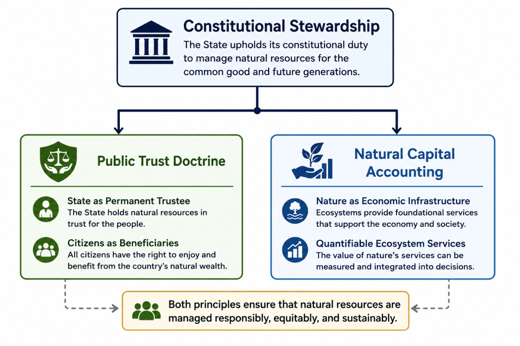
IV. Constitutional Boundaries: The Public Trust Intersection
Despite its market-oriented mechanics, the SFLMA operates within rigid constitutional boundaries. Under Section 2, Article XII of the 1987 Philippine Constitution, all lands of the public domain and natural resources belong to the State under the Regalian Doctrine (Jura Regalia). Because public forest lands are inalienable, the SFLMA does not transfer ownership. Instead, it grants restricted stewardship and management rights, explicitly conditioned upon the continuous fulfillment of environmental obligations.
This arrangement operationalizes the constitutional philosophy that property bears a social function, meaning the right to utilize natural resources is inherently subordinated to the welfare of the common good. Consequently, the SFLMA sits at a complex legal intersection:
Under the Public Trust Doctrine, the State serves as the perpetual trustee of the nation’s natural wealth, while private and community actors function as temporary, fiduciary stewards. Every SFLMA project must therefore operate within legally defined ecological limits, ensuring that the exploitation of the asset does not impair the underlying public trust.
V. Systemic Risks, Drawbacks, and Structural Critiques
While structurally ambitious, the SFLMA framework exhibits several vulnerabilities, regulatory gaps, and socio-ecological risks that require rigorous mitigation.
1. The Commercialization of Ecospace and Greenwashing
By treating forests as natural capital, there is an immediate risk that environmental governance becomes subordinated to market incentives. If forests are valued primarily for their carbon credit yields and commercial ESG returns, biodiversity and deep ecological integrity may take a backseat.
This commercial focus invites structural greenwashing. Without robust, third-party verification protocols and data-driven carbon audit registries, corporate actors might exploit SFLMA concessions as cheap corporate branding vehicles. Weak state oversight could lead to speculative carbon banking, double-counting of offsets, and the generation of low-integrity carbon credits that fail to achieve genuine additionality.
2. Corporate Concession Dominance and Elite Capture
The framework permits large-scale corporate participation, allowing single entities to hold management rights over extensive tracts of land—in some instances up to 40,000 hectares. This high ceiling raises significant concerns regarding elite capture and land concentration. If large conglomerates dominate the competitive allocation of Potential Investment Areas (PIAs), smaller cooperatives, local civil society organizations, and marginalized upland communities may be priced out of the environmental asset market entirely.
3. Overlaps with Ancestral Domains and IP Exploitation
Spatial mapping data from the DENR indicates a critical geographic tension: approximately 85% of identified SFLMA parcels partially overlap with roughly 15% of ancestral domains occupied by Indigenous Cultural Communities (ICCs) and Indigenous Peoples (IPs).
While the law mandates compliance with the Free and Prior Informed Consent (FPIC) process under the Indigenous Peoples’ Rights Act (IPRA), there is a structural risk that this participation becomes merely transactional or symbolic. If indigenous communities lack equal bargaining power or sophisticated legal representation, they may find themselves excluded from meaningful benefit-sharing mechanisms and long-term project governance.
4. Ecological Conversion and Monoculture Risks
From an ecological standpoint, carbon-sequestration math often favors fast-growing, non-native commercial species over complex, slow-growing native silviculture. Policy research from the University of the Philippines warns that if regulatory safeguards are weak, the SFLMA could inadvertently incentivize the conversion of remaining natural secondary forests into simplified agroforestry or monoculture plantation systems, compromising local biodiversity and watershed resilience in the name of carbon maximization.
5. Regulatory Capture and Institutional Capacity Gaps
Simultaneously managing and auditing more than one million hectares of geographically dispersed forest lands demands an unprecedented level of technical, technological, and regulatory oversight. The DENR currently faces significant budgetary, staffing, and technological constraints. Without advanced remote sensing, real-time drone monitoring, and corruption-resistant auditing platforms, the SFLMA framework remains vulnerable to regulatory capture, illicit land conversions, and enforcement failures on the ground.
VI. Conclusion: Anchoring the Future Framework
The SFLMA brings a foundational tension in modern environmental law to the forefront: Should nature be governed primarily as an inviolable public trust, or as a quantifiable economic asset?
The doctrinal significance of DAO No. 2025-22 lies in its attempt to merge these two paradigms. It demonstrates that the Philippines is actively transitioning from a legacy of reactive environmental regulation to a proactive strategy of environmental asset governance.
The policy challenge moving forward is not whether the Philippines should participate in global climate finance or build domestic carbon markets; rather, it is whether these market mechanisms can remain firmly anchored to constitutional stewardship, social justice, and the principle of intergenerational responsibility (Oposa v. Factoran).
The ultimate success of Philippine carbon governance will depend on the state’s ability to develop a comprehensive legal framework that balances private economic utilization with robust public accountability, ensuring that all environmental assets are managed to serve the common good. The SFLMA has opened the door to market-based conservation; the onus is now on the state, civil society, and private sector to build the governance architecture required to walk through it responsibly.
Selected references and links:
DENR Administrative Orders and press releases (look up DAO No. 2025‑22 on DENR website): https://denr.gov.ph (search for DAO 2025‑22 / SFLMA)
University of the Philippines forest restoration research (sample reference): search UP Los Baños / College of Forestry and Natural Resources publications on reforestation and monoculture risks.
The controversy surrounding Ronald dela Rosa is often discussed through the language of individual constitutional rights. Public debates revolve around due process, habeas corpus, unlawful arrest, jurisdiction, and the limits of state power. Lawyers argue over warrants, detention, treaty obligations, and procedural safeguards. In the courtroom and in legal commentary, the central figure becomes the accused individual whose liberty is under threat. Yet beneath this procedural surface lies a deeper and more uncomfortable question: why does society seem more consumed with the constitutional rights of the accused than with the collective rights of the victims whose deaths, suffering, and grievances gave rise to the controversy in the first place?
The answer lies in the very history of constitutional democracy itself. Modern constitutional systems were born out of humanity’s long struggle against unchecked political power. For centuries, rulers possessed enormous authority over life and liberty. Kings imprisoned enemies without trial, governments confiscated property at will, and political dissent was often crushed through violence or arbitrary detention. In response, constitutionalism emerged as a shield for the individual against the State. The great constitutional traditions of the world—from the Magna Carta to the modern Bill of Rights—were fundamentally designed to restrain governmental power. Thus arose the core protections now deeply embedded in democratic societies: due process, presumption of innocence, right to counsel, protection against arbitrary arrest, and the writ of habeas corpus.
These rights were intentionally crafted to protect even the unpopular, the accused, and the politically vulnerable. Constitutional law assumes that if rights apply only to the favored or the innocent, then they are not truly rights at all. This is why legal discourse instinctively focuses on the liberty of the person facing arrest or detention. Courts are structurally designed to examine whether the State acted lawfully before they examine the larger political or moral implications of a case. The immediate question becomes whether government power was exercised within constitutional limits.
But modern constitutionalism did not stop with the protection of individual liberty. Over time, societies realized that an excessive emphasis on individual rights alone could also produce injustice. Industrial inequality, systemic oppression, human rights abuses, and social violence revealed that society itself possesses legitimate interests deserving constitutional protection. Thus emerged the concept of collective rights: the rights of communities to justice, security, dignity, accountability, and social order. Modern constitutions increasingly recognized that the law must not only protect individuals from the State but also protect society from impunity and institutional abuse.
This tension becomes especially visible in cases involving alleged large-scale killings or crimes against humanity. The victims are no longer viewed merely as isolated individuals. Their deaths become part of a broader societal injury. Families seek truth. Communities seek accountability. Society demands recognition that human dignity was violated on a collective scale. In this context, supporters of accountability argue that focusing solely on the procedural rights of the accused risks reducing constitutional law into a purely technical exercise while the suffering of victims fades into the background.
International criminal law reflects this shift in perspective. Traditional criminal law generally frames cases as disputes between the State and the accused. But international criminal law reframes certain acts as offenses against humanity itself. Institutions such as the International Criminal Court operate on the principle that some crimes are so grave that they implicate not only individual victims but the moral conscience of the international community. Under this framework, justice is no longer exclusively about punishing offenders; it also involves acknowledging victims, preserving collective memory, and preventing future impunity.
Yet constitutional democracies remain cautious. They understand the danger of allowing collective outrage to overwhelm individual liberty. History repeatedly demonstrates that governments invoking “public welfare” or “justice” can become instruments of persecution if procedural safeguards disappear. Without due process, even noble causes may evolve into authoritarian practices. This is why constitutional systems insist that the rights of the accused must still be respected, even in emotionally charged or politically divisive cases.
At the same time, there is also danger in the opposite extreme. If society becomes so focused on procedural protections that accountability becomes nearly impossible, public trust in institutions erodes. Victims begin to feel invisible. Justice appears selective or inaccessible. Constitutional rights may then be perceived not as instruments of liberty but as shields for impunity. The law therefore stands in a constant struggle to maintain equilibrium between liberty and accountability, between individual protection and collective justice.
This same constitutional tension exists beyond criminal law. In expropriation, for example, the Constitution protects private property while simultaneously recognizing the State’s authority to take land for public use upon payment of just compensation. Neither the individual property owner nor the collective needs of society absolutely prevail. Instead, the Constitution attempts to balance both through due process and fairness. Modern constitutional democracy operates on this same balancing principle across many areas of law.
Ultimately, the controversy surrounding Bato is not merely about one senator, one arrest, or one procedural remedy. It is part of a larger constitutional conversation about the direction of democratic society itself. The real issue is whether a constitutional order can simultaneously protect the liberty of the accused while honoring the rights of victims and society’s demand for justice. That tension may never fully disappear because it reflects the very complexity of human civilization. Constitutional democracy survives not by choosing only liberty or only collective justice, but by continually attempting to reconcile both within the rule of law.
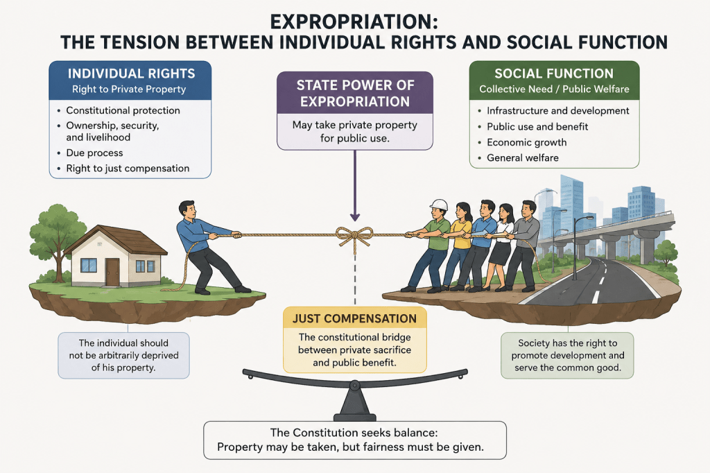
Expropriation is often discussed as a procedural mechanism through which the government acquires private property for roads, bridges, transmission lines, airports, flood control systems, and other public infrastructure. Yet beneath its procedural framework lies one of the deepest constitutional tensions in democratic governance — the tension between the rights of the individual and the demands of the collective.
At the center of every expropriation case is a constitutional balancing process. On one side stands the individual property owner invoking the protection of the Bill of Rights. On the other side stands the State acting in the name of public welfare, infrastructure development, and societal necessity. Eminent domain exists precisely because constitutional democracy recognizes both interests as legitimate.
The Constitution protects private property because ownership is deeply tied to liberty, security, livelihood, and human dignity. Land is not merely a commodity or economic asset. For many families, property represents inheritance, identity, social stability, and intergenerational survival. The taking of property therefore affects more than physical land; it interferes with constitutionally protected expectations and rights.
This is why Article III, Section 9 of the Constitution declares that private property shall not be taken for public use without just compensation. The provision reflects the recognition that while the State may possess sovereign authority to compel the transfer of property for public purposes, such power is never absolute. The Constitution restrains governmental authority by imposing safeguards grounded on fairness and due process.
At the same time, society itself possesses collective needs that cannot be ignored. Modern civilization depends upon infrastructure and public systems that require land. Roads, railways, ports, schools, hospitals, power lines, flood control projects, water systems, and transportation corridors cannot materialize without space. Urbanization, economic development, environmental protection, and disaster resilience increasingly require coordinated public intervention over land use and spatial development.
Without the power of eminent domain, public infrastructure could easily become hostage to fragmented ownership or strategic refusal to sell. Collective welfare would become difficult, if not impossible, to achieve.
Thus, expropriation emerges as a constitutional compromise between private ownership and public necessity. The State may compel the taking of private property for public use, but society cannot impose the burden of public development upon a single owner without compensation. Just compensation therefore becomes the constitutional bridge between collective benefit and private sacrifice.
In many ways, just compensation reflects a principle of distributive justice. If society benefits collectively from a public project, then society — acting through the State — must fairly compensate the individual whose property was sacrificed for that collective benefit. The owner may not necessarily prevent a lawful taking for public use, but the owner possesses the constitutional right to receive the full and fair equivalent of the property taken.
This explains why the Supreme Court consistently emphasizes that the determination of just compensation is a judicial function. Courts serve as constitutional arbiters between governmental power and individual rights. The judiciary ensures that compensation is not dictated solely by political convenience, administrative valuation schedules, or institutional interests. Judicial review prevents the possibility that the coercive power of the State overwhelms constitutional fairness.
The valuation process itself therefore acquires constitutional significance. In expropriation, appraisal is no longer merely technical or commercial. Market value becomes part of constitutional justice. An undervalued appraisal effectively forces the landowner to subsidize public infrastructure unfairly. Conversely, an excessive valuation burdens public resources and ultimately affects society as a whole. The objective is constitutional equilibrium — fairness both to the owner and to the public.
This constitutional balancing also explains the critical role of commissioners under Rule 67 of the Rules of Court. Commissioners are not representatives of the expropriating agency nor advocates for the landowner. They are auxiliaries of the court tasked to assist in the fair and impartial determination of just compensation. Their role carries constitutional implications because they participate directly in balancing individual rights against collective societal interests.
For this reason, the Rules require commissioners to be competent and disinterested. Independence is essential because once valuation becomes driven by institutional loyalty, political pressure, or predetermined outcomes, the constitutional integrity of the expropriation process begins to erode.
The tension between individual rights and collective welfare has become even more complex in contemporary society. Today, expropriation increasingly intersects with climate adaptation, environmental protection, renewable energy, urban redevelopment, mass transportation, disaster mitigation, and sustainability planning. Governments now justify takings not only for traditional infrastructure, but also for broader societal objectives involving environmental resilience and long-term public survival.
As collective interests expand, however, constitutional protections remain indispensable. The challenge of modern governance is not simply to accelerate development, but to ensure that development remains constitutionally just.
This evolving landscape also transforms the nature of property law itself. Expropriation can no longer be understood solely as a procedural remedy or land acquisition mechanism. It now exists at the intersection of constitutional law, valuation, urban planning, economics, environmental governance, and infrastructure policy.
The future property lawyer, appraiser, and land governance specialist must therefore understand not only ownership doctrines and legal procedures, but also how land functions within broader economic, environmental, and societal systems. Questions involving just compensation increasingly require appreciation of market behavior, zoning, infrastructure externalities, environmental regulation, and public policy.
Ultimately, expropriation reflects one of the most profound realities of constitutional democracy: ownership is protected, but ownership is not absolute. Property carries both private rights and social obligations. The State may compel individual sacrifice for the collective good, but the Constitution insists that such sacrifice must never occur without fairness, due process, and just compensation.
That enduring balance between individual rights and collective welfare remains the true constitutional essence of eminent domain.
Brief History of Individual and Collective Rights
The history of political and constitutional philosophy reveals a continuing tension between collective authority and individual liberty. In the ancient and medieval world, collective order, political community, and social hierarchy largely dominated over individual autonomy. The individual was viewed primarily as part of the larger social or political body.
From this collective order eventually emerged the philosophy of individual rights during the Enlightenment. Thinkers such as Locke and other liberal philosophers asserted that human beings possess inherent natural rights — life, liberty, and property — which the State must respect rather than create. This intellectual movement eventually gave rise to liberal constitutionalism and the modern Bill of Rights, where the protection of the individual against arbitrary governmental power became central.
However, the rise of industrialization, economic inequality, labor exploitation, and other societal problems exposed the limitations of purely individualistic systems. As a result, constitutional thought gradually evolved once again toward social rights and collective welfare. Modern constitutions increasingly recognized labor rights, social justice, environmental protection, public welfare, and the social function of property.
Today, modern constitutionalism attempts to balance both traditions. Contemporary constitutions protect individual rights and liberties while simultaneously recognizing legitimate collective interests necessary for social order, development, and public welfare. Thus, modern constitutional law is ultimately an ongoing effort to reconcile individual freedom with the demands of society as a whole.
One of the recurring constitutional tensions in land use regulation and infrastructure development is the blurred line between police power and eminent domain. Government agencies and local government units often invoke public welfare, regulation, or urban necessity to justify interference with private property rights. Yet the Constitution draws a critical distinction: regulation may be allowed without compensation, but taking requires the payment of just compensation.
This distinction was strongly reaffirmed by the Supreme Court inBanco de Oro v. South Rich Acres, G.R. Nos. 202384 and 202397, decided on May 4, 2021.
The case arose from a dispute involving Marcos Alvarez Avenue in Las Piñas City. South Rich Acres, Inc. (SRA) and Top Service, Inc. owned several parcels of land comprising the road. Over time, the road became heavily used by motorists and residents, eventually functioning as an important access route within the area.
Invoking public welfare and long public use, the City Government of Las Piñas enacted City Ordinance No. 343-97 declaring Marcos Alvarez Avenue a public road. The City essentially argued that the ordinance was merely a regulatory measure under the State’s police power, especially considering the public character the road had already assumed through years of use.
SRA and Top Service challenged the ordinance, arguing that the City had effectively deprived them of ownership and control of their property without payment of just compensation. Meanwhile, Equitable PCI Bank — now Banco de Oro Unibank, Inc. — intervened and supported the City’s position, arguing that subdivision roads had already become public under laws such as.
The Supreme Court rejected these arguments and declared the ordinance unconstitutional.
The Court ruled that the City’s action was not a mere regulation under police power, but an actual taking of private property for public use. Although the road had long been used by the public, the property remained privately titled. Declaring it public through ordinance effectively transferred the beneficial use and control of the property to the public without payment of compensation.
The decision is significant because it sharply clarifies the constitutional distinction between police power and eminent domain.
Police power allows the State to regulate property to promote public welfare, safety, health, and order. Regulation may impose restrictions on how property is used, but ownership remains with the private owner. Since the government merely regulates rather than appropriates the property, compensation is generally unnecessary.
Eminent domain, however, is fundamentally different. It involves the actual taking or appropriation of private property for public use. Once government action effectively deprives the owner of dominion, beneficial use, control, or economic value of the property, the Constitution requires payment of just compensation.
In Banco de Oro v. South Rich Acres, the Court concluded that the ordinance crossed the line from regulation into appropriation. The ordinance did not simply regulate traffic or impose land use restrictions. It effectively converted privately owned property into public property without compensation. The Court viewed the measure as a classic example of eminent domain disguised as police power.
The ruling sends an important warning to local government units and public agencies. Government cannot avoid the constitutional requirements of eminent domain by simply labeling an act as regulation or public welfare legislation. The nature of governmental action is determined not by its title, but by its actual effect on property rights.
This issue is not merely theoretical. It frequently surfaces in actual governance and land use discussions. In one discussion involving an LGU, a public official advocated the use of police power as a basis for utilizing private property for public purposes without compensation. The conversation highlighted how easily the distinction between police power and eminent domain can become blurred in practice, particularly when public infrastructure, access roads, easements, open spaces, or urban development objectives are involved.
This is precisely why the Banco de Oro ruling is highly instructive for LGU executives, planners, assessors, engineers, lawyers, and real estate practitioners alike.
The danger arises when governmental bodies attempt to justify what is effectively a taking under the language of regulation or public welfare. In practice, LGUs may invoke police power to justify road access, public use corridors, environmental restrictions, or land use controls without fully appreciating that certain measures may already constitute compensable taking under the Constitution.
The Supreme Court reminds us that courts will always look beyond labels and examine the actual effect of governmental action on property rights. A measure framed as zoning regulation, traffic management, environmental control, or public welfare legislation may still amount to eminent domain if it effectively converts private property into public use or substantially deprives the owner of beneficial ownership and economic utility.
For LGU executives, the case serves as a constitutional governance guidepost. Public purpose alone does not automatically validate uncompensated intrusion into private property rights. Constitutional safeguards remain applicable even when the intended objective is beneficial to the public.
For real estate practitioners, appraisers, consultants, and lawyers, the distinction is equally important in advising clients, evaluating government actions, assessing damages, and determining whether a governmental measure has crossed the line from regulation into compensable taking.
The case is especially relevant today as infrastructure expansion, urban redevelopment, environmental regulation, and public utility projects increasingly intersect with private property rights. The pressure to accelerate public projects often creates institutional temptation to blur constitutional boundaries in the name of efficiency or public necessity.
But the Constitution imposes limits.
The power of eminent domain remains one of the most intrusive powers of the State because it authorizes the compulsory taking of private property. For this reason, the constitutional guarantee of just compensation serves not merely as a procedural requirement, but as a safeguard against arbitrary deprivation of property.
Banco de Oro v. South Rich Acres reinforces a fundamental constitutional principle: police power cannot be used as a shortcut to acquire private property without compensation. Once regulation crosses the line into appropriation, the State must comply with the constitutional safeguards governing eminent domain.
For further reading, here is the link of the case.
In the recent case of, the Supreme Court clarified an important jurisdictional distinction involving condominium disputes and criminal violations under.
The case stemmed from a condominium transaction where the buyer filed a criminal complaint for violation of P.D. 957 against the developer. During the proceedings, the RTC not only resolved the criminal aspect of the case but also ruled on contractual matters arising from the parties’ Contract to Sell, including reimbursement and delivery of the condominium unit.
The Supreme Court ruled that while the RTC properly exercised jurisdiction over the criminal prosecution, it had no jurisdiction over the contractual disputes between the buyer and the developer.
According to the Court, the civil liability imposed by the RTC was not civil liability arising from the crime (ex delicto), but civil liability arising from contract (ex contractu). Since the source of the obligation was contractual, jurisdiction belonged exclusively to the HLURB — now the (HSAC) — under P.D. No. 1344.
The Court emphasized that disputes involving:
refund,
reimbursement,
delivery of condominium units,
specific performance, and
other buyer-developer contractual obligations
fall within the exclusive jurisdiction of the HLURB/HSAC and must be filed separately from the criminal case.
As a result, the RTC’s ruling on the contractual civil aspect was declared void for lack of subject matter jurisdiction.
The ruling is significant because it reinforces the distinction between civil liability ex delicto and civil liability ex contractu. While civil liability arising from a crime may generally be impliedly instituted with the criminal action, this rule does not apply when the obligation arises from contract. In such cases, jurisdiction is determined not by the criminal charge, but by the nature of the contractual dispute and the special law granting exclusive jurisdiction to the HLURB/HSAC.
The decision serves as an important reminder for lawyers, real estate practitioners, and condominium buyers that criminal proceedings under P.D. 957 do not automatically authorize regular courts to resolve contractual disputes reserved by law to specialized housing adjudication bodies.
For further reading, here is the link of the case:
A recent court hearing involving an expropriation case provided an important and revealing glimpse into the realities of litigation appraisal and the role of commissioners under Rule 67 of the Rules of Court. The proceeding highlighted not only the technical demands of valuation in expropriation cases, but also the constitutional importance of independence and competence among commissioners appointed to assist the court.
In the hearing, one of the commissioners nominated by the plaintiff, the National Grid Corporation of the Philippines (NGCP), was placed on the witness stand and subjected to cross-examination. The commissioner testified that she had served for around thirty years with Napocor and NGCP and had appeared in more than 300 expropriation proceedings as commissioner. On the surface, the credentials appeared extensive and impressive.
However, as the testimony progressed, serious questions emerged regarding the valuation approach and the commissioner’s understanding of her role under Rule 67.
Under Sections 6 and 7 of Rule 67, commissioners occupy a unique position in expropriation proceedings. They are not ordinary witnesses, nor are they advocates for the parties who nominated them. Commissioners are auxiliaries of the court — technical aides tasked to assist the judge in determining just compensation. Because expropriation involves the constitutional taking of private property, the Rules expressly require commissioners to be “competent and disinterested.”
The hearing illustrated why these qualifications are indispensable.
Although the commissioner presented three comparable sales in her report, she ultimately anchored her conclusion on the BIR zonal value and treated it as the basis for just compensation. Defense counsel immediately challenged this methodology, correctly arguing that BIR zonal values are primarily intended for taxation purposes and are not, by themselves, determinative of market value in expropriation proceedings.
Even the trial judge appeared unconvinced and questioned why the valuation could not exceed the zonal value despite the comparable market indicators presented in the report. The commissioner’s response — “makatapal mi ana, Judge” — became a telling moment during the hearing.
At that point, the issue ceased to be merely methodological. It became a question of competence, independence, and fidelity to the commissioner’s duty under Rule 67.
The situation became even more significant when defense counsel asked whether, as an NGCP engineer, the commissioner was protecting the interests of the company. The commissioner answered in the affirmative.
That admission goes directly to the heart of the Rules of Court. A commissioner is not appointed to protect the interests of either the expropriating agency or the landowner. The commissioner’s duty is owed to the court. The obligation is to provide an independent, objective, and professionally defensible opinion to assist the judge in arriving at just compensation. Once a commissioner openly identifies with the interests of one party, the requirement that the commissioner be “disinterested” is placed into serious question.
The hearing likewise provides valuable lessons for new appraisers and those planning to enter litigation appraisal practice.
Courtroom valuation is fundamentally different from ordinary appraisal assignments conducted for banks, internal corporate use, or taxation purposes. In litigation, every assumption, adjustment, methodology, comparable sale, and conclusion may be subjected to intense scrutiny through cross-examination and judicial evaluation. A report is not judged merely by how it is written, but by whether it can withstand legal and technical examination under oath.
More importantly, litigation appraisal is not simply about arriving at a value. It is about demonstrating professional independence, analytical rigor, credibility, and ethical discipline. An appraiser who enters the courtroom without a strong grasp of valuation principles, legal standards, evidentiary requirements, and the constitutional framework governing just compensation risks not only discrediting the report, but also undermining the court’s search for fairness.
The hearing also reflects a broader concern within expropriation practice. There remains a tendency among some commissioners and agency appraisers to treat zonal values as ceilings rather than mere tax benchmarks. Others become overly aligned with institutional interests. But the constitutional standard is neither convenience nor accommodation. The constitutional standard is just compensation.
At the final analysis, the courtroom remains the ultimate testing ground of appraisal practice. Reports must not only be prepared — they must be defensible. Opinions must not only be asserted — they must be supported by evidence, methodology, and independent reasoning. Above all, the appraiser must remember that the duty is not to produce a value desired by a party, but to assist the court in the fair and impartial determination of value.
I recently wrote a comment on the Central Visayas Regional Development Plan 2023–2028 examining the region from the perspective of regional economics, spatial planning, and archipelagic development. The paper has likewise been formally transmitted to the Regional Development Council (RDC-VII) and the Department of Economy, Planning, and Development (DepDev) Region VII for their consideration as part of the broader discussion on the future development trajectory of Central Visayas.
I believe that sharing these discussions with the broader public is equally important. Regional development planning should not remain confined solely within technical institutions, planning agencies, or government offices. The future of Central Visayas affects communities, businesses, local governments, professionals, environmental sectors, transport systems, housing systems, and the broader regional economy itself. Public discussion, academic engagement, and policy discourse are therefore essential in strengthening long-term regional planning and institutional decision-making.
For decades, development in Central Visayas has largely been driven by infrastructure expansion, metropolitan growth, and connectivity. In many ways, this strategy worked. Metro Cebu emerged as the country’s second major metropolitan economy outside Metro Manila, supported by expanding ports, airports, logistics systems, tourism, and commercial activity.
But beneath this success lies a deeper regional challenge.
Central Visayas is not simply a metropolitan corridor—it is an archipelagic regional economy composed of fragmented island systems heavily dependent on transportation, maritime connectivity, logistics, and coastal urbanization. Cebu and Bohol alone consist of hundreds of islands and islets linked through ports, ferry systems, airports, tourism corridors, and inter-island transportation networks.
In archipelagic economies, infrastructure plays a dual role. Connectivity strengthens mobility, trade, tourism, and economic integration. At the same time, however, it also concentrates economic activity around dominant urban-maritime nodes. In the Visayas, that node became Metro Cebu.
Over time, Metro Cebu evolved into the region’s dominant metropolitan intermediary, integrating transportation systems, labor mobility, logistics networks, tourism activity, and higher-order urban functions across interconnected island economies. This generated rapid economic growth, with Central Visayas becoming one of the Philippines’ fastest-growing regional economies.
Yet the same concentration dynamics also intensified traffic congestion, infrastructure saturation, housing pressures, rising land values, flooding vulnerability, watershed encroachment, and ecological stress. Many peripheral territories likewise became increasingly dependent upon Metro Cebu for employment, transportation access, investment flows, logistics systems, and higher-order services.
The long-term challenge confronting Central Visayas is therefore no longer simply how to expand infrastructure or accelerate metropolitan growth. The deeper issue concerns whether regional integration can generate more territorially distributed, ecologically sustainable, climate-responsive, and production-oriented development across the broader Visayas archipelago.
Ultimately, the future of Central Visayas may depend not merely upon building a stronger metropolis, but upon building a stronger and more resilient archipelagic regional economy.
Today, Gus Agosto, a licensed Environmental Planner, sent his formal reply to the Department of Human Settlements and Urban Development (DHSUD), signaling a continuing exchange on the review of the Cebu City Comprehensive Land Use Plan (CLUP) 2023–2032.
The exchange brings into focus a critical issue in Philippine land use planning: the alignment of existing planning practices with Republic Act No. 11995, or the Philippine Ecosystem and Natural Capital Accounting System (PENCAS) Act.
Gus Agosto, a former ADB Consultant, stressed that “the law is already in force.” Consequently, its requirements—especially the integration of environmental and natural capital considerations into planning and decision-making—are neither prospective nor optional, but are binding elements of the existing legal framework governing land use.
While the Department has emphasized the need for technical readiness, including the development of standardized datasets and frameworks, it is important to underscore that institutional readiness does not suspend legal obligation. A clear distinction must be made between full technical implementation and minimum compliance. Even at present, there are sufficient tools—such as hazard mapping, watershed delineation, and environmental constraints analysis—to begin integrating ecological limits into planning decisions.
Deferring integration to the “next CLUP cycle,” which may span nearly a decade, risks allowing land use decisions to proceed under frameworks that do not reflect current legal and environmental realities. In a region like Cebu, which continues to face recurring disasters and environmental stress, such delay raises serious concerns about the adequacy of planning safeguards.
Recent events—including the Binaliw dumpsite collapse in January 2026 and the widespread devastation caused by Typhoon Tino in 2025—underscore the real-world consequences of land use decisions that fail to fully account for environmental risks. These incidents highlight the urgency of ensuring that planning frameworks evolve in step with both law and lived experience.
“The issue is not whether we can fully implement PENCAS today, but whether we can justify continuing to approve land use decisions that ignore a law already in force. We already know where the risks are. The responsibility now is to ensure that planning decisions reflect that reality—before the next disaster forces the correction.” Consultant Agosto said.
The objective is not to disrupt planning processes, but to strengthen them. A transitional approach—where PENCAS principles are integrated to the extent practicable while full systems are being developed—offers a balanced and legally sound path forward.
The question is not whether we are ready to implement the law, but whether we can afford not to.
Following is my letter reply to the DHSUD:
HON. ATTY. RAMON QUINTIN CLAUDIO C. ALLADO Undersecretary Department of Human Settlements and Urban Development (DHSUD) Kalayaan Avenue, Diliman Quezon City
CC : DIRECTOR, LEGAL SERVICE
Re: Response to DHSUD Letter dated 16 February 2026 On the Review and Implementation of the Cebu City CLUP 2023–2032
Dear Undersecretary Allado:
I acknowledge receipt of your letter dated 16 February 2026 concerning the review and implementation of the Cebu City Comprehensive Land Use Plan (CLUP) 2023–2032 in relation to the Philippine Ecosystem and Natural Capital Accounting System Act (PENCAS, Republic Act No. 11995).
While I appreciate the Department’s recognition of natural capital accounting’s role in land use planning, I respectfully register strong reservations regarding the proposal to defer its integration until complete frameworks, datasets, and guidelines are issued—or to limit it to the next CLUP cycle.
1. Immediate Binding Effect of the PENCAS Act
Republic Act No. 11995 is in full force and binds all government agencies, including DHSUD, in their administrative functions. The absence of complete technical frameworks or datasets does not suspend this obligation; administrative convenience cannot supersede a statutory mandate.
2. CLUP Approval as a Continuing Administrative Act
CLUP review and approval constitute an ongoing administrative function that must align with laws in effect at the time of the decision. Approving a CLUP without incorporating PENCAS requirements undermines its substantive legal validity, irrespective of procedural compliance.
3. Impropriety of Deferral to the Next Cycle
Deferring the integration of PENCAS to the “next cycle”—effectively a decade from the current 2023–2032 planning horizon, especially in a context marked by historical delays in plan updating—is untenable in the face of recurring and intensifying disasters in Cebu. Recent events, including the January 2026 Binaliw dumpsite collapse that claimed 36 lives, and Typhoon Tino (2025), which left at least 158 fatalities, dozens missing, and thousands injured across Compostela, Liloan, Balamban, Danao City, and Cebu City, underscore the grave consequences of inadequate land use planning.
These incidents are not isolated occurrences, but manifestations of systemic vulnerabilities—many of which may be linked to outdated or insufficiently responsive planning frameworks. In this light, a policy of deferring compliance with the PENCAS Act risks perpetuating land use decisions that fail to reflect environmental constraints and hazard realities. This, in turn, increases foreseeable risk and undermines the duty of planning authorities to align land use regulation with existing legal mandates and evolving environmental conditions.
4. Distinction Between Full Implementation and Minimum Compliance
Full technical implementation may await standardized systems, but minimum transitional compliance is feasible now using available tools like hazard mapping, watershed delineation, and environmental constraints analysis. Ecological limits can thus inform planning without full PENCAS operationalization.
5. Request for Clarification
In view of the above, I respectfully seek clarification on:
i. Whether DHSUD plans to approve CLUPs omitting PENCAS requirements;
ii. Whether interim or minimum compliance measures apply to LGUs pending full PENCAS rollout; and
iii. Whether the Department contemplates transitional guidelines to align current planning with legal mandates.
6. Reservation of Rights
This letter is without prejudice to further actions to ensure land use planning complies with the law and addresses environmental and developmental imperatives.
7. Closing
My intent is not to hinder planning but to affirm that natural capital integration is now a legal imperative, not mere policy.